WRAL Weather Alert Day ends, isolated storms possible Thursday afternoon
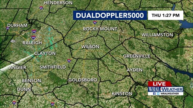
Isolated storms will be possible Thursday afternoon, but the WRAL Weather Alert Day has ended.
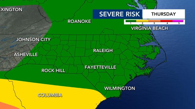
After some brief lightning and heavy rain south of the Triangle on Thursday morning, the area was downgraded to a Level 1 risk as storms began to clear out.
WRAL meteorologist Elizabeth Gardner said a few spotty storms will still be possible Thursday afternoon, but severe weather isn't likely.

- Thursday: Rain clears, isolated afternoon storms possible. Breezy with a high of 86.
- Friday: Partly cloudy, cooler and less humid with a few showers and storms possible. Level 1 risk for severe storms in our southern counties. Highs in the low 80s.
- Saturday: Partly cloudy skies, cooler and less humid. High of 74.
Thursday will be a windy afternoon with gusts up to 35 mph. It's going to be another hot and muggy day, with temperatures climbing into the 80s by the afternoon.
Live DUALDoppler5000 | Check conditions across NC: WRAL Live Cam Network | What is a WRAL Weather Alert Day?
There were some tornado warnings in South Carolina overnight but few severe weather reports in North Carolina. The most severe weather was south and west of the Triangle, close to Charlotte, and in Tennessee Wednesday night.
WCNC Charlotte reports Wednesday's storms left downed trees, and widespread outages across the Charlotte area. Many flights out of Charlotte Douglas Airport were delayed or canceled due to the storms. Wednesday afternoon, Gaston County officials said a person was killed when a tree fell on a car.
Level 1 risk for severe storms Friday
Another round of non-severe storms is likely Friday afternoon.
We now have a Level 1 risk for our southern counties on Friday. Damaging winds will be possible in the afternoon as our cold front arrives. Scattered storms will be possible Friday afternoon.

Gardner said damaging winds will be the biggest threat, and rain will be heavy at times on Friday.

After a wet Friday, Mother's Day weekend kicks off with cooler, more spring-like temperatures and plenty of sun.

Clouds clear out as the day goes by on Saturday, and the high will reach 74 degrees.
"Over the weekend, we get the nice, refreshing feel back," said WRAL meteorologist Kat Campbell.
On Sunday, for Mother's Day, the high is 79 degrees with mostly clear skies – a perfect day for an outdoor brunch or garden visit to celebrate mom.
- Guide to the best brunch spots in the Triangle
- Top 5 spas in the Triangle: Where luxury meets wellness
- The best outdoor dining spots in Raleigh
- WRAL Azalea Gardens: Everything you need to know for your visit
- Raleigh's flower trail: Your guide to the best blooms and springtime trails
7-day forecast for central NC
- Thursday: Spotty showers possible in the afternoon. High of 86.
- Friday: Partly cloudy, cooler and less humid with a few showers and storms possible. Level 1 risk for severe storms in our southern counties. Highs in the low 80s.
- Saturday: Partly cloudy skies, cooler and less humid. High of 74.
- Sunday: Happy Mother's Day! It's partly cloudy and a touch warmer, but humidity levels should still be on the comfortable side. Highs in the upper 70s.
- Monday: Mostly sunny skies and a tad warmer with still comfy humidity levels. Highs in the low 80s.
- Tuesday: Mostly cloudy skies with a few showers and storms possible this afternoon and into tonight. Highs in the upper 70s.
- Wednesday: Mostly cloudy skies with showers and storms still looking possible. Highs in the low 80s.

Prepare for a busy 2024 Atlantic hurricane season
The 2024 Atlantic hurricane season will see 15 to 20 named storms in the Atlantic basin, according to researchers at North Carolina State University.
The number of named storms is significantly higher than the long-term average and moderately higher than recent 30-year averages, according to Lian Xie, professor of marine, earth and atmospheric sciences at N.C. State.
In 2024, N.C. State researchers predict:
- 15-20 named storms
- 10 to 12 may grow strong enough to become hurricanes (the historical average is six)
- Three to four becoming major hurricanes
Meanwhile, forecasters at Colorado State University are calling for 24 named storms in the 2024 Atlantic hurricane season, which runs from June 1 through Nov. 30. That is higher than the average year, when 14 storms earn a name.
CSU forecasters say 11 storms will reach hurricane strength, up from the average of seven, and five of those hurricanes could be "major," that is Category 3, 4 or 5, with winds over 111 mph.


